Hydrometeorologic,
Gelologic, Chemical and Sanitary Risks in the World and Mexico.
Population
is exposed to a large range of natural processes or anthropic actions (caused
by humankind).
A risk
implies the presence of a factor or event of diverse origin:
*
Underground fractures or faults
* Possible
landslides or flooding zones
* High
seismicity zones
* Closeness
to chemical or gas industries
The risk is
higher when there are great people
settlements close to active volcanoes, in zones of high seismicity or hurricane
impact zones and also if there is no adequate organization for disaster
prevention.
Risks can
be classified like this:
|
Process
|
Examples
|
|
Natural
|
Geological
|
Earthquakes, volcanic eruption, erosion,
collapses , seaquakes, sinking.
|
|
Hydrometeorological
|
Hurricanes, tornados, dust storms, flooding,
hailstorms, frost, draughts, tropical storms.
|
|
Anthropic
|
Chemical-technological
|
Fires, explosions, gas leaks, petroleum and
toxic substances spills (liquid or gas kinds), dangerous waste.
|
|
Sanitary-ecological
|
Water ,soil, air, food pollution:
Epidemies and plagues.
|
|
Socio-organizational
|
In massive concentrations: terrestrial,
flying, sailing and rain accidents. Public
services interruption.
|
The
extension of space where the disaster occurs varies in order to the strength
and length of the event. Since 2011, the
amounts of disasters kept showing the impact that natural disasters have in
human health and society.
A disaster
is called so when the following two circumstances appear:
* Violent
emergence of a high destructive power phenomenon that affects a region or zone.
* The
existence of a community vulnerable to its impact.
Vulnerability is how susceptible a population is
to suffer damage. Population that live in rural zones is more vulnerable because it would be harder for them to
rebuild their houses and recover their agriculture products or livestock.
A disaster
can also provoke epidemics, scarcity of food and losing jobs. Recovery may be
faster and easier in urban zones. In central cities they are more vulnerable to
terrorist attacks and anthropic risks.
Poor
populations, because of their lack of money sometimes establish themselves in
high risk zones, like seismic, volcanic, close to tectonic faults or affected
by hurricanes and flooding and in housing built with inappropriate techniques
and materials. (Like a house built with cardboard and metal sheets.
Other
factors that incide vulnerability are:
* Inefficiency
of public services
* Lack of
education on disaster prevention
* Not
enough infrastructure to help all the population in case of disaster
* Passive
attitude of the population
A disaster
happens when two factors combine: Risk and vulnerability.
Risk + Vulnerability = Disaster
The study
of disasters social impact is very important. The main indicators are:
* Number of
people death and hurt
* Amount of
victims of damage
* Housing
and work buildings damage
Population
is more vulnerable to unpredictable phenomena like earthquakes, which cause
huge damage to life and material goods. Predictable phenomenon gives some time
to be prepared and take security measures (like cyclones) in which damages are
less.
The areas
with higher frequency and strength of hydrometeorological phenomena are the
places with lots of rain and cyclones. There rivers overflow, flooding,
landslide, lose of soil, beaches sand, agriculture products, livestock and
housing happen in them.
Other big
disasters are caused by technologic origin like toxic substances spill (PETROLEUM),
fires, nuclear accidents, air, water and soil pollution as well. Other dangers
of anthropologic origin are wars that favour epidemics, famine (people in
hunger conditions) and environment destruction.
Mount
Vesuvius
Vesuvius has 4 typical types
of eruptions:
1. Plinian (such as the 79 AD Pompeii eruption): extremely large
explosive eruptions producing several to several tens of cubic km of magma in a
very short time.
2. Sub-Plinian explosive eruptions (such as the 1631 eruption). They are
similar in style, but smaller than true Plinian events.
3. Strombolian and Vulcanian eruptions (several examples during the
1631-1944 period, e.g. 1906 and 1944). Such eruptions produce local heavy
tephra falls, small pyroclastic flows, as well as large fire fountains and lava
flows.
4. The smallest, but most frequent type of activity observed at Vesuvius is persistent
Strombolian to Hawaiian-style activity that prevailed during much of the
period between 1631 and 1944. This activity is usually limited to the central
crater, and sometimes to flank vents. Lava flows and lava fountains have been
frequently observed during such periods of activity.
Eruptions of 1796 - 1822, 1824 -
1834, 1835 - 1839, 1841 - 16 February 1850, 1854 - 1855, 1855 - 1861, 1864 -
1868, 1870 - 1872, 1875 - 1906, 1913 - 4 April 1944
Krakatoa -
the world's most infamous volcano
The island group of
Krakatoa (or Krakatau) lies in the Sunda Strait between Java and Sumatra.
Krakatoa is infamous for its violent Plinian eruption in 1883, that destroyed
the previous volcanic edifice and enlarged its caldera.
Collapse of the former volcanic edifice, perhaps in 416 AD, had formed a
7-km-wide caldera. Remnants of this ancestral volcano are preserved in Verlaten
and Lang Islands; subsequently Rakata, Danan and Perbuwatan volcanoes were
formed, coalescing to create the pre-1883 Krakatoa island. Caldera collapse
during the catastrophic 1883 eruption destroyed Danan and Perbuwatan volcanoes,
and left only a remnant of Rakata volcano.
This eruption, the 2nd largest in Indonesia during historical time (the most
violent being the eruption of Tambora in 1815), caused more than 36,000
fatalities, most as a result of devastating tsunamis that swept the adjacent
coastlines of Sumatra and Java. Pyroclastic surges traveled 40 km across the
Sunda Strait and reached the Sumatra coast. After a quiescence of less than a
half century, the post-collapse cone of Anak Krakatoa ("Child of
Krakatoa") was constructed within the 1883 caldera at a point between the
former cones of Danan and Perbuwatan. Anak Krakatau has been the site of frequent
eruptions since 1927.
|
Time
|
Mag. / Depth
|
Distance
|
LocationNo recent
earthquakes
|
Background:
Renowned Montagne Pelée,
forming the northern end of the island of Martinique, is the most active
volcano of the Lesser Antilles arc. Three major edifice failures since the late
Pleistocene, the last about 9000 years ago, have left large horseshoe-shaped calderas
breached to the SW inside which the modern volcano has been constructed. More
than 20 major eruptions have occurred at Pelée during the past 5000 years.
Extensive pyroclastic-flow deposits, incised by steep-walled ravines, mantle
the slopes of the volcano. The l'Etang Sec summit crater is filled by two lava
domes emplaced during the 1902 and 1929 eruptions. Historical eruptions date
back to the 18th century; only two modest phreatic or phreatomagmatic eruptions
took place prior to 1902. The catastrophic 1902 eruption, which destroyed the
city of St. Pierre, the "Pearl of the Lesser Antilles," became the
type-example of pelean eruptions and marked the onset of modern volcanological
studies of the behavior of pyroclastic flows.
Popocatépetl volcano
Last update: 8 May 2013
(steam and ash emissions, intermittent explosions)
Typical eruption style: Dominantly explosive, construction of lava
domes. Plinian eruptions at intervals of several centuries or few thousands of
years, vulcanian and strombolian activity in intermittent phases.
Popocatépetl
volcano eruptions: 1345-47, 1354, 1363(?), 1488, 1504, 1509(?), 1512,
1518, 1519-23(?), 1528, 1530, 1539-40, 1542, 1548, 1571, 1580, 1590, 1592-94, 1642,
1663-65, 1666-67, 1697, 1720, 1802-04, 1827(?), 1834(?), 1852(?), 1919-22,
1923-24, 1925-27(?), 1933, 1942-43, 1947, 1994-95, 1996-2003, 2004-ongoing
Last
earthquakes nearby:
|
Time
|
Mag. / Depth
|
Distance
|
Location
|
|
Mon, 6 May
|
|
|
Mon, 6 May 08:33 UTC
|
M 3.4 / 3 km
|
2 km
|
19 km al ESTE de OZUMBA, MEX
|
|
Tue, 30 Apr
|
|
|
Tue, 30 Apr 16:09 UTC
|
M 3.2 / 3 km
|
24 km
|
2 km al NOROESTE de S ANDRES MIXQUIC, DF
|
Popocatepetl
is one of Mexico's most active volcanoes. After almost 50 years of dormancy,
"Popo" came back to life in 1994 and has since then been producing
powerful explosions at irregular intervals.
In the past centuries before European invasions, large eruptions produced giant
mud flows that have buried Atztec settlements, even entire pyramids.
Background:
Popocatépetl, whose name is
the Aztec word for smoking mountain, towers to 5426 m 70 km SE of Mexico City
to form North America's 2nd-highest volcano. The glacier-clad stratovolcano
contains a steep-walled, 250-450 m deep crater. The generally symmetrical
volcano is modified by the sharp-peaked Ventorrillo on the NW, a remnant of an
earlier volcano.
At least three previous major cones were destroyed by gravitational failure
during the Pleistocene, producing massive debris-avalanche deposits covering
broad areas south of the volcano. The modern volcano was constructed to the
south of the late-Pleistocene to Holocene El Fraile cone. Three major plinian
eruptions, the most recent of which took place about 800 AD, have occurred from
Popocatépetl since the mid Holocene, accompanied by pyroclastic flows and
voluminous lahars that swept basins below the volcano. Frequent historical
eruptions, first recorded in Aztec codices, have occurred since precolumbian
time.
Environment Degradation and
Natural Disasters in the World and Mexico
Natural
events like earthquakes, hurricanes and tsunamis cause bigger disaster because
their intensity and frequency.
Geologic
risks, volcanic eruptions and earthquakes cause great environmental damage.
Fires are another kind of risks that impact on the environment because they
destroy woods, biodiversity and grassland.
Social
disasters produce great lost (explosions, toxic substances spills, epidemics)
that affect the environment and population.
A disaster
causes direct and indirect loss. Direct are immediately evident (death, destruction
of infrastructure, cultural and private patrimony, etc. Indirect are the social
and economic consequences as people relocation, sicknesses and epidemics, ack
of food and housing destruction.
Economic
activity is affected when stores and
services buildings are destroyed, there is jobs , touristic commercial and
industrial loss.
Because of
its geographic position Mexico is exposed to different kind of geologic and
hydrometeorologic disasters. More than one third of Mexican population lives in
high risk zonesnmainly in Guerrero, Oaxaca and Chiapas because of preassure of
ocean plates of the Pacific, Cocos and Northamerican that produce igh volcanic
activity.
Mexico is
also a zone of hidrometeorological risk because hurricane impact and is
vulnerable to suffer floodings because of its flowing rivers.
The majority
of a disaster effects are caused by hurricanes that are strong at the coasts of Mexico specially
the south and southeast of the country, in contrast with the north states like
Coahuila, Durango and San Luis Potosi that are vulnerable to disasters caused
by droughts.
A thyphoon
is a cyclone originated in the west
Pacific and Indic Ocean (Japan, China).
Social
damage is higher if there isn’t an adequate organization of the authorities and
society to have shelter, medicine, medical help, food and all the necessary
support of an affected population.
To decrease
population vulnerability and risk it is very important to spread prevention
culture and education, people must be organized trained in emergency situations
and work together with the prevention steps with authorities in charge.
Two thirds
of the country are in seismic risk because to Cocos and Northamerican
subduction plates. Being located at the Pacific Fire Ring in
Mexico there are a great number of volcanoes: Colima, Popocatépetl, Ceboruco,
Tacaná and Chinchón.
Mexico is
located in a inter-tropical region and that’s why each year there are around 20
cyclones, 4 or 5 of which get into our
territory and cause big damage like
flooding and landslides at Pacific and Gulf of Mexico and Caribbean coasts.
 Welcome to something we like to call the hydrosphere! This is where we talk about the way water moves through the world. Water affects everything that happens in life. In Latin, "hydro" means water. Therefore, anything that scientists describe, when it comes to water, is a part of the HYDROsphere. That water may be at the bottom of the ocean or in the top layers of the atmosphere; it is all a part of the hydrosphere.
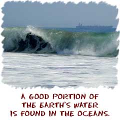
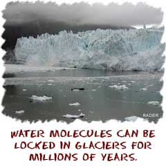 Liquid water makes the Earth a special place. Our planet has a very nice temperature range that allows water to remain in its liquid state. If we were a colder object like Pluto, it would not matter how much water there was on the planet; it would all be frozen. On the other hand, if we were on a very hot planet, all of the water would be in a gaseous state. Water vapor and solid water are useless to the living organisms found on Earth. Since the hydrosphere includes all of the water on the planet, you will study all of the various states of water. There will be solids in the deep glaciers, liquids of the oceans, and the vapor state of clouds.


